Back Perm Afrikaans Пермь ALT ፕየርም Amharic بيرم (روسيا) Arabic Perm AST Perm AVK Perm Azerbaijani پرم AZB Пермь Bashkir Перм Byelorussian
This article has multiple issues. Please help improve it or discuss these issues on the talk page. (Learn how and when to remove these template messages)
|
Perm
Пермь | |
|---|---|
|
From the top to the left: Kama River and Art Gallery (former Transfiguration Cathedral), Perm Embankment near the Motovilikha plant, A view over the city of Perm, Krasavinsky bridge | |
| Coordinates: 58°00′N 56°19′E / 58.000°N 56.317°E | |
| Country | Russia |
| Federal subject | Perm Krai[1] |
| Founded | May 15, 1723 |
| City status since | October 29, 1781 |
| Government | |
| • Body | Perm City Duma[2] |
| • Mayor[3] | Eduard Sosnin[3] |
| Area | |
| • Total | 799.68 km2 (308.76 sq mi) |
| Elevation | 171 m (561 ft) |
| Population | |
| • Total | 991,162 |
| • Estimate (2018)[7] | 1,051,583 (+6.1%) |
| • Rank | 13th in 2010 |
| • Density | 1,200/km2 (3,200/sq mi) |
| • Subordinated to | city of krai significance of Perm[1] |
| • Capital of | Perm Krai,[1] Permsky District[1] |
| • Urban okrug | Perm Urban Okrug[8] |
| • Capital of | Perm Urban Okrug,[8] Permsky Municipal District[9] |
| Time zone | UTC+5 (MSK+2 |
| Postal code(s)[11] | 614xxx |
| Dialing code(s) | +7 342[12] |
| OKTMO ID | 57701000001 |
| City Day | June 12 |
| Website | www |
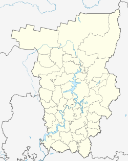
Perm (Russian: Пермь, IPA: [pʲermʲ] ⓘ; Komi-Permyak: Перем; Komi: Перым), previously known as Yagoshikha (Ягошиха) (1723–1781), and Molotov (Молотов) (1940–1957), is the largest city and the administrative centre of Perm Krai, Russia. The city is located on the banks of the Kama River, near the Ural Mountains, covering an area of 799.68 square kilometres (308.76 square miles), with a population of over one million residents.[13] Perm is the fifteenth-largest city in Russia, and the fifth-largest city in the Volga Federal District.
In 1723, a copper-smelting works was founded at the village of Yagoshikha. In 1781 the settlement of Yagoshikha became the town of Perm. Perm's position on the navigable Kama River, leading to the Volga, and on the Siberian Route across the Ural Mountains, helped it become an important trade and manufacturing centre. It also lay along the Trans-Siberian Railway. Perm grew considerably as industrialization proceeded in the Urals during the Soviet period, and in 1940 was named Molotov in honour of Vyacheslav Molotov. In 1957 the city returned to its historical name.
Modern Perm is still a major railway hub and one of the chief industrial centers of the Urals region. The city's diversified metallurgical and engineering industries produce equipment and machine tools for the petroleum and coal industries, as well as agricultural machinery. A major petroleum refinery uses oil transported by pipeline from the West Siberian oilfields, and the city's large chemical industry makes fertilizers and dyes. The city's institutions of higher education include the Perm A.M. Gorky State University, founded in 1916.
- ^ a b c d e f Cite error: The named reference
Ref127was invoked but never defined (see the help page). - ^ Пермская Городская Дума perm.ru (in Russian)
- ^ a b Official website of the Head of Perm Archived November 21, 2016, at the Wayback Machine (in Russian)
- ^ "Áàçà äàííûõ ïîêàçàòåëåé ìóíèöèïàëüíûõ îáðàçîâàíèé". gks.ru. Russia.
- ^ Error: Unable to display the reference properly. See the documentation for details.
- ^ Russian Federal State Statistics Service (2011). Всероссийская перепись населения 2010 года. Том 1 [2010 All-Russian Population Census, vol. 1]. Всероссийская перепись населения 2010 года [2010 All-Russia Population Census] (in Russian). Federal State Statistics Service.
- ^ "26. Численность постоянного населения Российской Федерации по муниципальным образованиям на 1 января 2018 года". Federal State Statistics Service. Retrieved January 23, 2019.
- ^ a b Cite error: The named reference
Ref843was invoked but never defined (see the help page). - ^ Law #1868-402
- ^ "Об исчислении времени". Официальный интернет-портал правовой информации (in Russian). June 3, 2011. Retrieved January 19, 2019.
- ^ Почта России. Информационно-вычислительный центр ОАСУ РПО. (Russian Post). Поиск объектов почтовой связи (Postal Objects Search) (in Russian)
- ^ Russian Federation - International Codes - The Phone Book from BT Archived April 13, 2014, at the Wayback Machine, Retrieved 2014-04-12
- ^ "RUSSIA: Privolžskij Federal'nyj Okrug: Volga Federal District". City Population.de. August 4, 2020. Retrieved October 20, 2020.
© MMXXIII Rich X Search. We shall prevail. All rights reserved. Rich X Search


